"One that has the remains of a ship embedded in its mantle."
Mountain ranges are the result of continental collision. When two plates carrying continental crust converge, crustal rocks are folded and faulted. The result is deformed, thickened crust. This thicker crust rests on the underlying mantle, floating on the denser mantle rocks just as an iceberg floats in water. Mountains also resemble icebergs in that the part you see is much smaller than the part hidden beneath the Earth's surface. The high topography of mountain ranges is mirrored by a much larger crustal root beneath. The height of mountains depends on the thickness of the crust, and the difference in density between the crust and the mantle. These relationships are part of the principle of isostasy, which governs how icebergs, mountains, and all other objects float.
"...kept watching other activities at the US Air Force missile base on Disko Island."
Disko Island (Kalaallisut: Qeqertarsuaq, Danish: Disko øer) is a large island in Baffin Bay, off the west coast of Greenland. It has an area of 8,578 km2 (3,312.0 sq mi), making it the second largest island of Greenland (after the main island of Greenland) and one of the 100 largest islands in the world. The name Qeqertarsuaq means The Large Island (from qeqertaq = island).

Qeqertarsuaq town on Disko Island

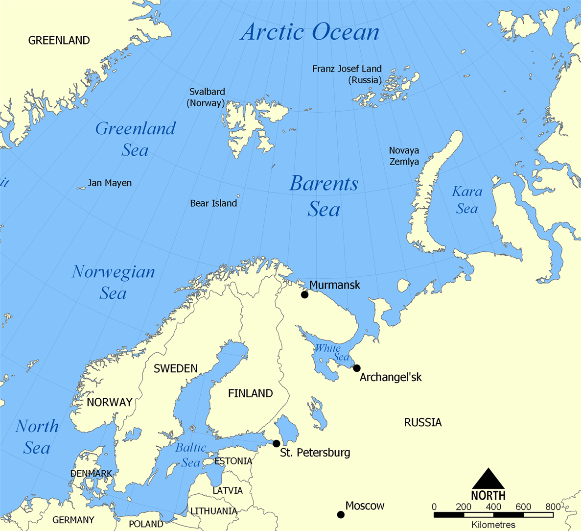
the other [route] was through the Barnets Sea to Murmansk
Barnets Sea is a typo. Cussler is talking about the Barents Sea.
The Barents Sea (Norwegian: Barentshavet, Russian: Баренцево море or Barentsevo More) is a marginal sea of the Arctic Ocean,[1] located north of Norway and Russia.[2] Known in the Middle Ages as the Murman Sea, the sea takes its current name from the Dutch navigator Willem Barents. It is a rather deep shelf sea (average depth 760 feet (230 m) and maximum depth 1,480 feet (450 m)), bordered by the shelf edge towards the Norwegian Sea in the west, the islands of Svalbard (Norway) in the northwest, and the islands of Franz Josef Land and Novaya Zemlya (Arkhangelsk Oblast) in the northeast and east. Novaya Zemlya separates the Kara Sea from the Barents Sea. Significant fossil fuel energy resources exist in the Barents Sea region.
No comments:
Post a Comment